Research on Data Fusion Method for Archaeological Site Identification
Product Description
Research on Data Fusion Method for Archaeological Site Identification
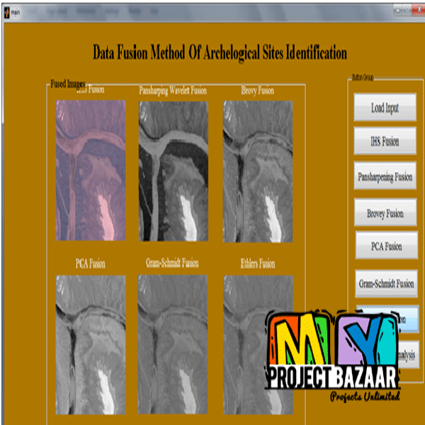
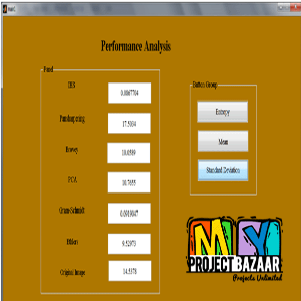
Abstract—China is the only country in the world with continuous ancient civilization whose history can be traced for more than 5000 years. With the rapid development of remote sensing, abundant remote sensing data of the same site by different remote sensors are available at the same time. How to make full use of these data and extract the useful information is one of the problems that have puzzled the remote sensing archaeological researchers. Data fusion provides effective means for remote sensing archaeology to recognize the archaeological sites. < Final Year Projects >The article selected the SPOT5 data, used the HSV transformation method, Brovey transformation method, Gram-Schmidt, Pansharping, Wavelet, PCA transformation method, HPF and Ehlers method and employed the quantitative evaluating indexes both from spatial and spectral information aspects to evaluate the fusion results, which were processed in the MATLAB. The results show that the fusion images by wavelet, PCA transformation method and GS transformation method have reserved the spectral information better; the Pansharping, Brovey and HSV methods can enrich the spatial information and enhance the contrast of features. Through evaluation, the Pansharping method shows the rich textural details that improved the archaeological site recognition best in Liangzhu ancient city. There is no denying that the fusion methods can enhance the information to different degrees, but an optimal fusion method should be employed according to the specific archaeological site. By data fusion, better understanding of the site extent, structure and organization may well be achieved.
Including Packages
Our Specialization
Support Service
Statistical Report

satisfied customers
3,589
Freelance projects
983
sales on Site
11,021
developers
175+Additional Information
| Domains | |
|---|---|
| Programming Language |


